
Cape of St. Vincent
Since the inauguration of the Rota Vicentina in 2013, these marked walking and cycling trails have been increasing in popularity and now attract visitors from all across Europe.
The concept is simple. Stretching from the ancient town of Santiago do Cacem in the north, to the Cape of St Vincent in the south, the Rota Vicentina is divided into two: the 120km Fishermen’s Trail (predominantly coastal paths used by locals and fishermen to reach the beaches of the Alentejo and the Algarve), and the 230km Historical Trail (predominantly a rural trail running through villages, cork forests and across agricultural land).
The Fishermen’s Trail and Historical Trail are then sub-divided into smaller one-day walks, each starting and ending in a small community where accommodation, meals and drinks are on offer. The maximum distance recommended on a one-day walk is 25km, this is the route between Sao Luis and Odemira, and the minimum distance between stages is just 6km.
The creation and promotion of the Rota Vicentina is sustainable tourism in action, with local residents benefiting from the increased spending in their area; from the protection of their natural surroundings and from a growing pride in the spectacular landscape that they call home and in the traditional customs that they can share with their guests.
Businesses are springing up along the route including new guesthouses, activity companies, transfer companies, artisan shops and restaurant/snack bars.
It has also helped to extend the holiday season in the region with most visitors choosing to walk or cycle the route (or parts of it) from September to early June, out of the heat of the summer sun. This is also the time of the harvests (September), wild flowers in bloom (March, April, May) and bird migrations (September and October).
I have recently spent a week walking five stages of the Rota Vicentina and would highly recommend it to anyone wishing to really experience the Alentejo and Algarve regions of Portugal. You will come across lone fishermen standing on the rocks; couples bathing on stretches of unspoiled and uncrowded golden sand; farmers plowing their fields; eucalyptus, cork and bamboo forests and traditional villages and towns where you will sit side-by-side with local residents enjoying their lunchtime break.
Is it easy? It depends on the route that you follow. Each of the trails is graded from Easy to Difficult so you can choose the best option for you. All you need is a good pair of walking shoes, a hat, an ample supply of water and your camera.
The routes I walked were:
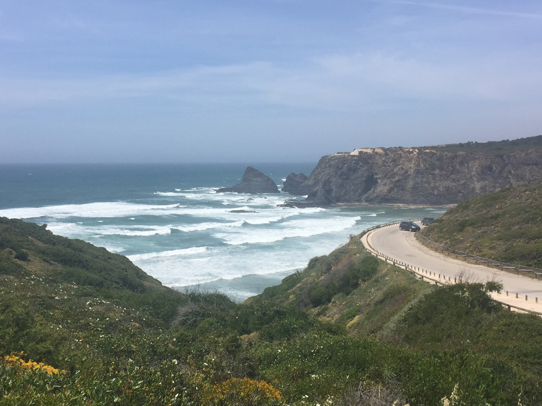
- Porto Covo to Vila Nova de Milfontes
Distance: 20km
Difficulty level: Difficult
Approximate duration: 7 hours
From the coastal town of Porto Corvo, the Fishermen’s Trail follows the Atlantic Coastline southwards to the estuary of the River Mira. A large proportion of the route is amongst the sand dunes that protect the region’s beaches and along the cliff top paths. The views are mesmerising and there are plenty of opportunities to take a dip or for a spot of sunbathing.
Porto Covo to Vila Nova de Milfontes
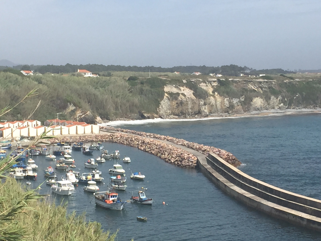
- Vila Nova de Milfontes to Almograve
Distance: 15km
Difficulty level: Somewhat difficult
Approximate duration: 5 hours
From the centre of Vila Nova de Milfontes, the Fishermen’s Trail crosses the estuary of the River Mira (a wonderful panorama) and journeys southwards towards the small coastal community of Almograve. Following close to the coastal path, you are rewarded with views of rocky and sandy coves as well as rural farms. This area is renowned for its swift population and we also saw a stork nesting on top of a sea stack.

Vila Nova de Milfontes to Almogra
- Odeceixe circuit
Distance: 9km
Difficulty level: Easy
Duration: 3 hours
The meandering River Seixe joins the Atlantic Ocean at Praia de Odeceixe. The landscape of the final stages of the river valley is spectacular. It is a scene of lush, green countryside, of wild flowers and of sandy riverbanks. The Odeceixe circuit is a circular trail which initially follows the valley from the town of Odeceixe to its beach, before climbing to the cliff tops as a coastal trail and then inland past small rural hamlets, farms and into the hills of Monchique.
Odeiceixe
- Pedralva to Vila do Bispo
Distance: 12.5km
Difficulty level:Easy
Duration: 3 hours
The idyllic white-washed rural village of Pedralva is a sight to behold; colourful shutters; bouganvillia clinging to the historic buildings and flower boxes brightening up the cobbled streets. From here, the walk travels southwards passing vegetable gardens, grazing areas and orchards before reaching a pine forest on the outskirts of Vila do Bispo. There are far reaching views towards the ocean as you approach the town
Pedralva to Vila do Bispo
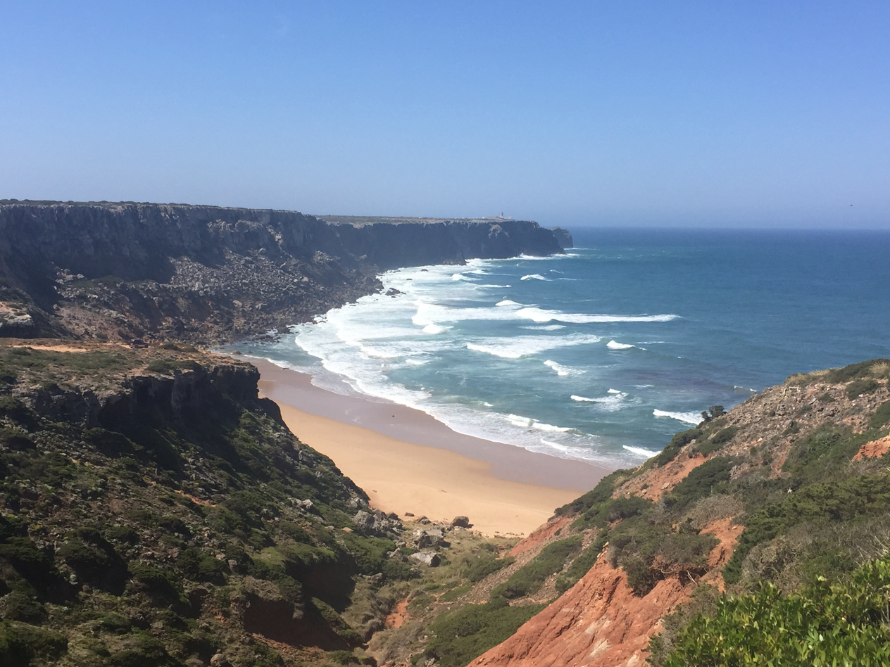
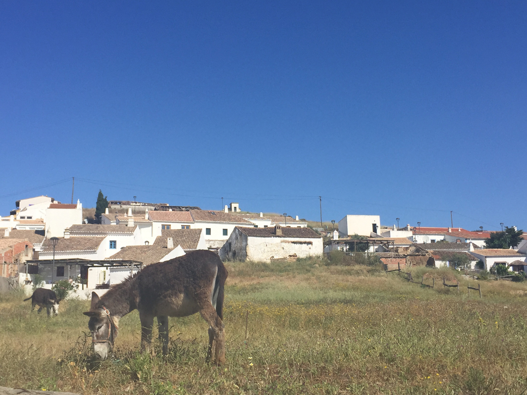
- Vila do Bispo to Cape of St. Vincent
Distance: 15km
Difficulty level: Somewhat difficult
Duration: 5 hours
From Vila do Bispo, the walk initially follows the Historical Trail passing grazing and farm land. Donkeys, cows and an abundance of butterflies and birds accompany you on your stroll. After about 5km the path splits and you can choose to follow the Telheiro Beach Circuit (Fishermen’s Trail) towards Cabo de Sao Vicente or continue on the Historical Trail. We choose the beach circuit with offers wonderful coastal panoramas throughout. On either route, the town of Sagres and the lighthouse of Cabo de Sao Vicente can be seen throughout.
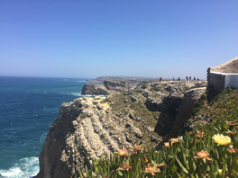
Cape of St. Vincent
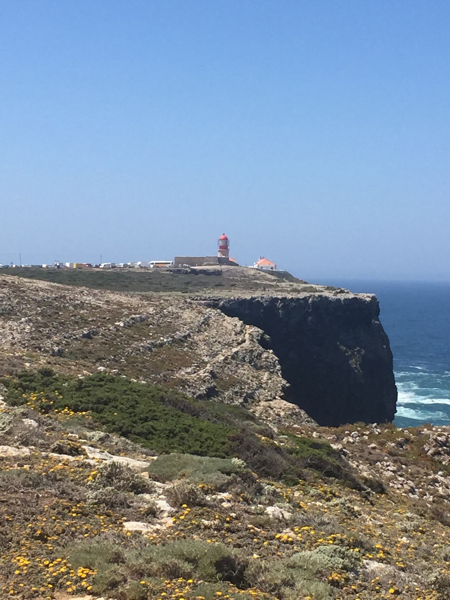
Lighthouse at Cape St. Vincent
Rachel Jelley,
Sunvil Discovery


